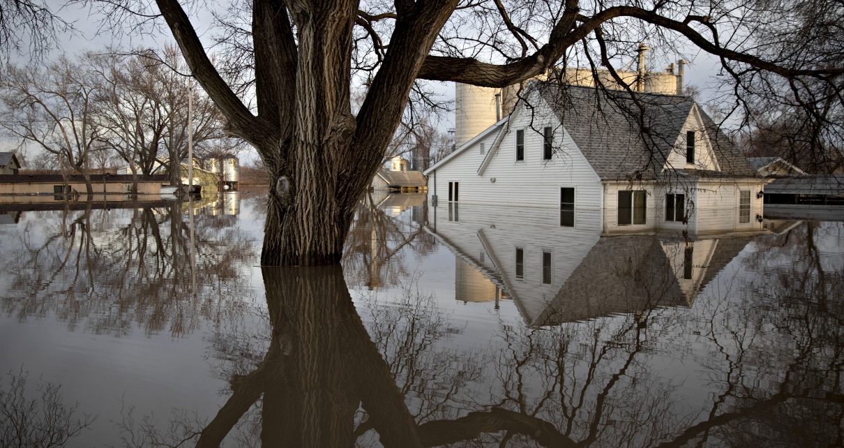
The Federal Emergency Management Agency has undercounted nearly 8 million homes and businesses that face substantial risk of flooding, placing more Americans in jeopardy from coastal storms, rising rivers and flash flooding, according to a new analysis from the nonprofit First Street Foundation.
The findings, based on advanced modeling of flood conditions under current and projected climate scenarios, show that FEMA’s estimates of properties with a 1% flood risk—meaning a property that’s expected to see major flooding once every 100 years—could be far too conservative.
The granular analysis, which accounts for sea-level rise, coastal storm surges, peak precipitation events and river flooding, means that homeowners have purchased properties in virtually every state without fully understanding their loss risk, the authors said.
Mortgage lenders and insurers also continue to finance and write policies for such properties without adequately accounting for flood risk. In most of those cases, the cost of flood damages falls on property owners.
“For a lot of people, they’ve just had no information previously, and this is going to be the first time that they’re actually going to see it and be able to understand what flood risk means to them personally,” Matthew Eby, First Street’s executive director, said during a briefing on Monday with reporters. “I do think that this will be a bit of a shock to some folks, but an important one that people can then understand and react appropriately versus continuing to operate with blinders on.”
He said the information would allow communities to make calculated decisions about flood risk rather than face a “binary choice” about risk based on a map line.
In addition to the report, First Street rolled out a new internet tool called Flood Factor that allows individuals to focus on neighborhoods or specific properties to see detailed flood risk information, including a 1-to-10 Flood Factor score for each mapped property address.
The report and Flood Factor tool reflect revolutionary advances in the way scientists calculate climate change risk using complex data models, evidence-based climate projections and even simulations that show how climate disasters would affect communities and properties, often using digitally enhanced overlays on base maps.
Similar analyses have been done by private-sector firms and university consortiums, and they have become important tools to help assess disaster risk in ways not previously possible.
Environmental groups have been critical of FEMA for its outdated flood maps and its slow pace of updating maps in areas with rising risk.
A FEMA spokesperson said the agency’s flood maps do not conflict with First Street’s findings, but “rather they complement one another by depicting different types of risk and will be helpful in different ways for an individual to determine flood risk.”
Moreover, the spokesperson said, “FEMA’s maps are notably different in their intended use and design,” and “the accuracy of the flood data necessary for making decisions regarding floodplain management or life and safety during a flooding event is different than the level of accuracy necessary to inform someone’s decision to acquire flood insurance or take an action to reduce their individual flood risk—what is called mitigation.”
Eby acknowledged that in many areas, FEMA’s maps align with First Street’s analysis of current and future flood risk. But some areas, including parts of South Florida and much of the Mid-Atlantic coast, face higher flood risk than FEMA’s maps indicate, partly because seas are rising and ocean water is growing warmer, making conditions riper for more severe storms.
While FEMA has worked to update its flood maps, especially in coastal zones, projected changes in climate conditions make risk assessments more elusive than ever.
In New Orleans, for example, where FEMA has paid considerable attention to flood risk since Hurricane Katrina, 98% of the city’s properties remain at risk of flooding, according to First Street. Statewide, the analysis found that nearly 1 million Louisiana properties will face flood risk by 2050.
Even under current climate conditions, some states and major cities are woefully undercounted with respect to flood risk. In both Chicago and Los Angeles, for example, more than 75,000 homes and businesses currently outside FEMA’s 1% flood risk zone could see such an event, according to the analysis.
Moreover, many of the nation’s “hidden properties” for flood risk are in inland areas—like Chattanooga, Tenn., and Charleston, W.Va.—as well as in communities of color and remote areas with high poverty rates and few opportunities for flood mitigation or adaptation.
Four Kentucky counties in the Appalachians, for example, contain 6,562 properties at risk of a major flood, according to FEMA. First Street’s modeling showed that 22,086 properties face substantial risk in those counties—more than three times as many.
In Cleveland County, Ark., FEMA maps placed 12 properties at substantial flood risk; First Street estimated more than 1,500 properties. And in Terrebonne Parish, La., one of the most exposed parts of the country to sea-level rise and hurricanes, First Street’s estimates doubled FEMA’s—35,017 properties versus 17,403 properties.
David Maurstad, FEMA’s deputy associate administrator for insurance and mitigation, said in a statement that the agency “is constantly working to improve the production of the Flood Insurance Rate Maps within the context of changing conditions,” adding that “FEMA’s flood maps remain the backbone of effective floodplain management.”
He said adoption of the FEMA maps’ minimum standards for flood mitigation has resulted in $100 billion in avoided losses over the past 40 years.
First Street’s analysis also accounted for state-level flood mitigation and adaptation strategies, finding that many of the highest-risk states had made efforts at flood mitigation either through gray infrastructure—like levees, flood walls and floodgates—or green infrastructure like wetland restoration and home buyouts to allow flood-prone neighborhoods to revert to a more natural state.
Witold Krajewski, a professor of civil and environmental engineering at the University of Iowa and director of the Iowa Flood Center, was one of three independent scientists to peer-review the First Street findings.
In an interview, Krajewski said the analysis provides a comprehensive look at flood risk on national, state and local levels, and that it provides an important tool for property owners who may otherwise fall into a risk trap.
“If you’re relying on FEMA, you know the boundary of that map, and that’s it,” Krajewski said. “So how can you even begin to compare what FEMA says with something that may extend outside those boundaries? It’s impossible.”
Reprinted from Climatewire with permission from E&E News. E&E provides daily coverage of essential energy and environmental news at www.eenews.net.


