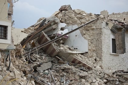
Using jack hammers and pick axes to dig through collapsed buildings, emergency responders are still finding those buried beneath the rubble.
Some are still alive after the February 6 magnitude 7.8 earthquake struck 3 days ago, but the death toll has risen to over 20,000. This is even greater than the 2011 earthquake off Fukushima, Japan, that triggered a tsunami, killing more than 18,400 people.
The Turkey earthquake struck around 4:15 a.m. local time in south central Turkey near the Turkey/Syria border. Just 11 minutes later, it was followed by a magnitude 6.7 aftershock. The largest aftershock at the time of writing was a M7.5 aftershock which struck 95 km (~60 miles) to the north. USGS observations and analyses indicate all these events are occurring within the East Anatolian fault system.
Though an earthquake of this magnitude is rare anywhere in the world, this type of earthquake that happened in Turkey is generally expected on long, plate-boundary strike-slip faults.
“It’s difficult to watch this tragedy unfold, especially since we’ve known for a long time that the buildings in the region were not designed to withstand earthquakes.”
USGS scientist David Wald added, “An earthquake this size has the potential to be damaging anywhere in the world, but many structures in this region are particularly vulnerable.”
The two largest earthquakes in the recent series are relatively shallow, with the mainshock 18 kilometers, or 11 miles, deep and the 7.5 magnitude aftershock at 10 kilometers (just over 6 miles) deep. Because the quakes are relatively shallow, the intensity of the shaking is severe.
M7.8 February 6, 2023 01:17:35 (UTC) Turkey mainshock and M4.5+ aftershocks as of February 6, 2023 19:12 (UTC). Orange circles are earthquakes that have occurred within the past 24 hours, and red circles are earthquakes that have occurred within the past 1 hour. The red line is the plate boundary.
“This earthquake produced intense shaking in the epicentral region,” said USGS scientist Kishor Jaiswal. “While newer buildings in other parts of Turkey (like Istanbul) are designed with modern earthquake standards in mind, the area affected by this earthquake included more vulnerable buildings, like older types of concrete frames that were not designed from seismic considerations to absorb this much ground motion.”
USGS has produced several products indicating likely damage, including a Ground Failure Estimates report that indicates a significant area and population is exposed to both landslide and liquefaction hazards as a result of the shaking.
Another USGS product is a report known as PAGER, short for Prompt Assessment of Global Earthquakes for Response. The PAGER report combines earthquake data, population density and structural vulnerability to estimate the number of people exposed to different amounts of shaking. It also provides estimates of potential fatalities and economic losses. The M7.8 mainshock registered RED for Economic Losses and Orange for Fatalities, indicating extensive damage is probable, the disaster is likely widespread, and that significant casualties are likely. The largest aftershock of magnitude 7.5 itself registered Orange for fatalities and economic losses on the USGS Pager impact report.
USGS is supporting partners in the region, such as the Kandilli Observatory and Earthquake Research Institute, as well other federal agencies by providing information products and images for partners that can help them understand the situation and ongoing risks of aftershocks.
As of February 6 evening (10:30 pm local time), around 30 aftershocks magnitude 4.5 and larger have been recorded between the Mediterranean Sea, 100 km (60 miles) to the southwest, and the city of Malatya, 200 km to the northeast. All of the tremors are taking place within the East Anatolian fault system. Aftershocks are expected to continue in the vicinity, which is a triple junction, a tectonically active area where three tectonic plates — Anatolia, Arabia, and Africa plates — touch and interact with each other.
Since 1970, only three earthquakes of magnitude 6 or larger have been registered in this region. The largest was a magnitude 6.7 that occurred January 24, 2020. See details about that event here.


